
Landair Surveys has partnered with a range of architecture, conservation, and construction professionals to deliver more than a decade’s worth of surveying projects across the University of Melbourne’s metropolitan and regional campuses.
Founded in 1853, the University of Melbourne is Victoria’s oldest tertiary institution and is widely recognised as Australia’s top-ranking university. With ten faculties spanning medicine, law, business, science, and engineering, the university operates eight campuses across the state, including key sites at Parkville, Creswick, Burnley, and Southbank.
Since 2014, Landair has completed over 60 individual surveying projects across four campuses. These have ranged from detailed 3D laser scans and rooftop drone flyovers to underground services surveys and construction setouts. A particular focus has been placed on the university’s significant heritage assets, including Parkville’s iconic Old Quad and historic forestry buildings at Creswick.
Landair’s scope of work has included:
– 20 laser scanning surveys of building façades and interiors
– 15 feature surveys supporting master planning and design
– 14 RPA flyovers capturing high-resolution rooftop conditions
– 7 underground services surveys for infrastructure upgrades
– 5 structural monitoring surveys
– 2 construction setout projects
– 2,500+ surveying hours across four campuses
Combining aerial and terrestrial data, Landair has produced a wide range of deliverables including façade elevation drawings, feature and title plans, building sections, and underground services layouts. Many of these data sets have supported heritage restoration, capital works planning, and ongoing facilities management.
3D terrestrial laser scanning
RPA drone imaging
Feature and underground services surveys
Monitoring and construction setout
Title re-establishment surveys
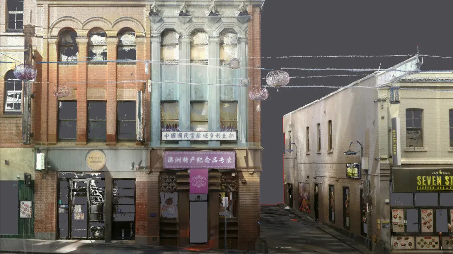
The Landair Survey team journeyed to the heart of China Town to measure the heritage facades at 109 Lt Bourke St on behalf of conservation specialists Conservation Studio.
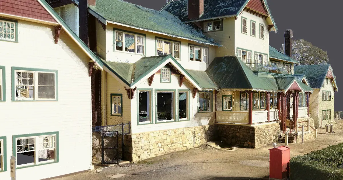
Landair Surveys was engaged by heritage architecture firm Conservation Studio to conduct a full existing-conditions survey of the Mt Buffalo Chalet, Victoria’s largest timber structure and Australia's first ski resort.
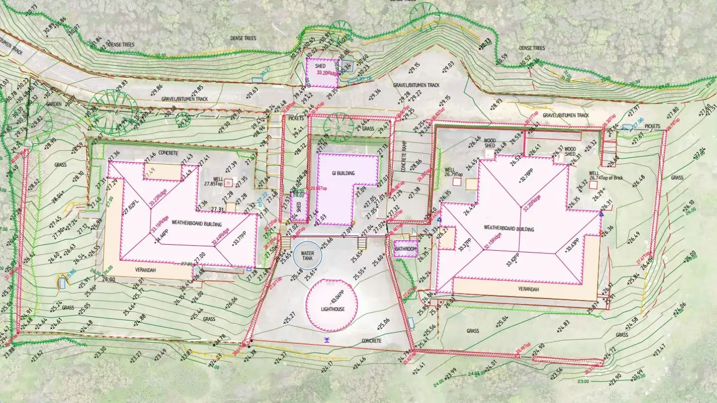
Heritage survey of Point Hicks Lightstation using 3D laser scanning and RPA flyovers to record the precinct for preservation.