
Landair Surveys have been performing bathymetric surveys for many years in Sydney and Melbourne. The dual frequency CEE-LINE Hydrographic Survey Echo Sounder enables us to not only measure the contours of the lake bed but also to measure the depth of sediment in lakes.
We have completed bathymetric surveys for:
A bathymetric survey measures the terrain of lakes, dams and ocean floors to determine the bed profile. It gives councils, engineers and site operators an accurate picture of what sits below the waterline. A typical survey captures:
From this data we prepare a model of the bed that shows exactly how the underwater surface sits and where material has built up.
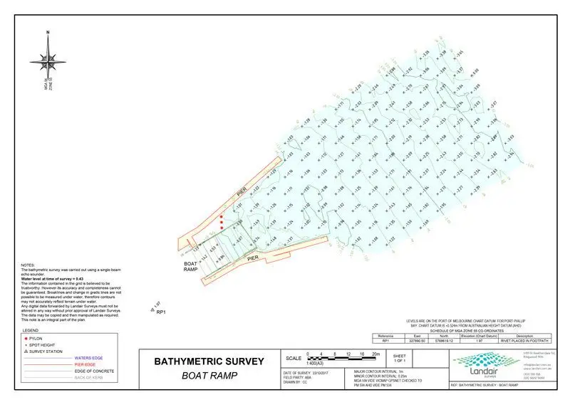
Bathymetric surveys determine the extent of dredging required, then verify its effectiveness. Since 2015 we have surveyed the sea beds near boat ramps from Mornington to Portsea each year, helping Mornington Peninsula Shire Council plan and confirm dredging operations.
Accurate bed levels and sediment thicknesses around boat ramps show where material is building up, so ramps remain operational and boating facilities stay safe and accessible.
Where a site holds water, a bathymetric survey captures the bed surface needed to calculate volumes accurately, working hand in hand with our volumetric surveys.
Where a development involves a lake, dam or other body of water, a bathymetric survey gives the project team an accurate record of existing bed conditions.
We prepare a model of the bed using a single-beam echo sounder in conjunction with a total station or survey-accurate GPS. In shallow waters we use RTK GNSS receivers to capture bed levels directly.
Our dual frequency CEE-LINE Hydrographic Survey Echo Sounder measures not only the contours of the bed but also the depth of sediment. That means one survey can report both the bed profile and the sediment thickness. Typical deliverables include:
Landair Surveys has been capturing spatial data since 1974, with quality checks under an ISO 9001 certified quality management system.
A bathymetric survey measures the terrain of lakes, dams or ocean floors to determine the bed profile. Using an echo sounder in conjunction with a total station or survey-accurate GPS, we prepare a model of the underwater surface.
Yes. Our dual frequency CEE-LINE Hydrographic Survey Echo Sounder measures both the contours of the bed and the depth of sediment, so dredging can be planned and its effectiveness verified.
We have been performing bathymetric surveys for years in Sydney and Melbourne, working from our Ringwood and Jamisontown offices.
A bathymetric survey captures the bed surface below the water, while a volumetric survey measures material volumes such as stockpiles and extraction areas. Together they support applications such as quarry volume calculations.