
Site Analysis Surveys are often required as part of the subdivision or property development process.
At Landair Surveys we produce site analysis surveys for architects and building designers, who use these surveys to design developments on land and to support planning permit applications with councils.
These plans show existing features and levels on the subject and adjoining land including:
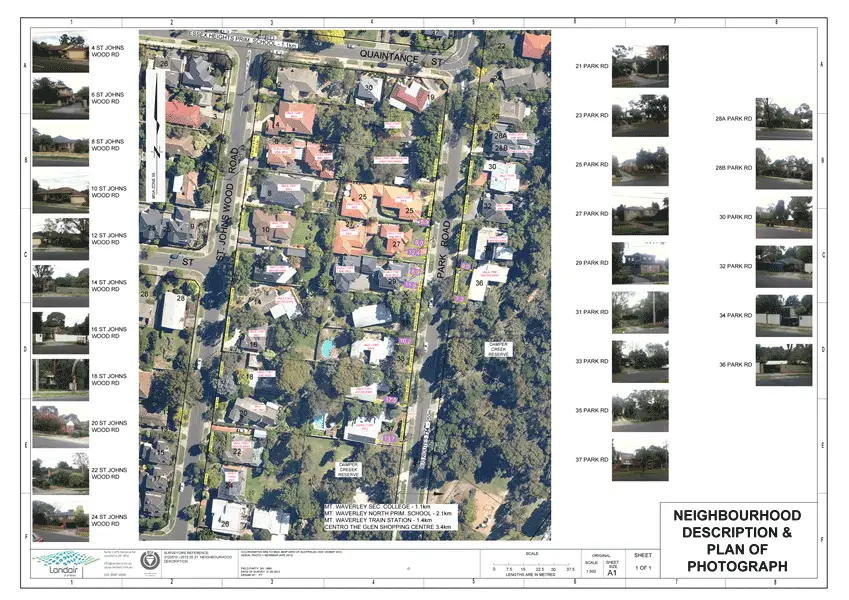
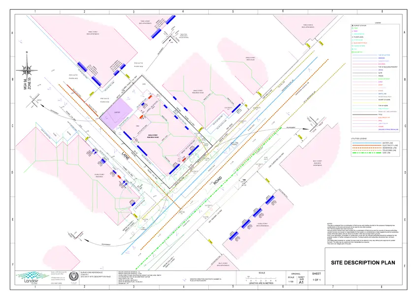
Site Analysis Surveys are also called ResCode Surveys, Site Descriptions and Site Context Plans.
A site analysis survey is a plan of the existing features and levels on your site and the adjoining land, prepared for architects and building designers who use it to design developments and to support planning permit applications with councils. It is often required as part of the subdivision or property development process, and you may also hear it called a ResCode survey, a site description or a site context plan.
The survey documents the context a council assessor and a designer both need to see, including:
If your project also needs a complete existing conditions plan of the site itself, see our feature and level surveying services. Landair Surveys has been capturing this kind of data since 1974, from offices in Melbourne and Sydney. Call 1300 130 158 to scope your survey.
Site analysis surveys (also known as ResCode surveys, site descriptions and site context plans) support planning permit applications with councils by documenting the existing features and levels a council needs to assess a proposal in its neighbourhood context.
We produce site analysis surveys for architects and building designers, who use them to design developments on land. Landair has decades of experience surveying for architects across Victoria and New South Wales, capturing everything from intricate detail to overall site context.
Site analysis surveys are often required as part of the subdivision or property development process. Pairing one with a feature and level survey gives your project team a full picture of existing conditions on the site and the land around it before design begins.
A Landair site analysis survey is delivered as plans prepared for design work and council submission:
Together these give architects, building designers and councils the site and neighbourhood information a development application relies on.
Yes. Site analysis surveys are also called ResCode surveys, site descriptions and site context plans. Different councils and designers use different names, but they refer to the same survey of existing features and levels on the subject and adjoining land.
Architects and building designers use them to design developments on land and to support planning permit applications with councils. They are often required as part of the subdivision or property development process.
A feature and level survey is a complete existing conditions plan of your site, capturing terrain, buildings, above-ground services, vegetation and surface detail. A site analysis survey extends the picture to the adjoining land and streetscape, documenting neighbourhood context for planning permit applications. The two are often prepared together at the start of a project.
Landair Surveys operates from Melbourne (Ringwood, VIC) and Sydney (Jamisontown, NSW), and has been surveying since 1974. Call 1300 130 158 to discuss your site.