
Our state-of-the-art PhaseOne 280i camera allows us to collect the near infrared band at the same time as the normal colour imagery. This data allows land managers and consultants to improve vegetation asset management by measuring environmental stresses.
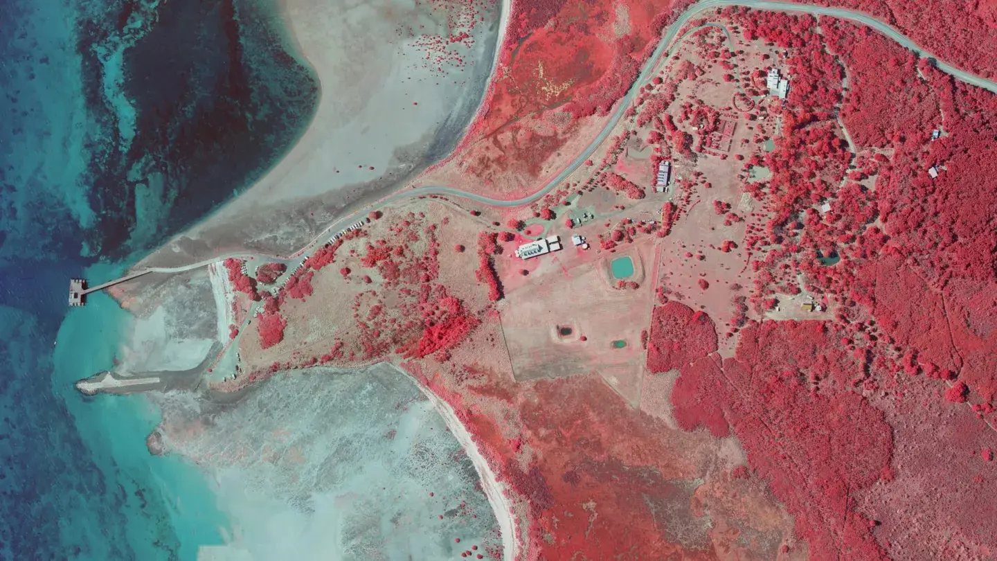
Indicators of pollution, water deficiency, nutrient stress and diseases on plant health can now be at your fingertips.
Our new surveying solution can help you and your team to control vegetation health impacted by floods, drought, bushfires and weeds.
Near-infrared imagery is aerial imagery that captures the near-infrared band of light at the same time as standard colour photography. The additional band allows land managers and environmental consultants to measure environmental stresses on vegetation, giving a clearer picture of plant health than colour imagery alone.
Indicators of vegetation condition become measurable across an entire site or region, including:
Processed into colour infrared (CIR) mosaics and vegetation indices, the data shows where vegetation is under stress and how it is responding.
Near-infrared data supports environmental projects from baseline land cover mapping through to change detection and ongoing monitoring. Repeat aerial photography flights can be scheduled to track vegetation health and regrowth over time.
Four-band imagery is processed into colour infrared (CIR) mosaics, vegetation indices, canopy height models and fractional vegetation cover maps. These layers support biodiversity mapping and carbon accounting, and are delivered as GIS-ready orthophotos.
Government land managers use four-band imagery for burn area mapping and fire severity and extent assessment. Landair captured planned burn sites across Victoria for DELWP, delivering four-band orthophotography tiles (RGBI) and overview mosaics in IR, RGB and CIR.
Landair captures near-infrared imagery from its own crewed twin-engine aircraft, flying the Vulcanair P68C supported by Piper Navajo and Cessna C205 platforms. The primary sensor is the PhaseOne 280i large format camera, a 280 megapixel four-band system with a 90mm lens for colour (RGB) and a 50mm lens for near-infrared. The Leica RCD30 is available as an additional system.
This is the same aircraft and sensor capability behind our aerial photography service, backed by a history stretching back to 1974.
It is used to measure environmental stresses on vegetation, revealing indicators of water deficiency, nutrient stress, disease and pollution, and helping land managers control vegetation impacted by floods, drought, bushfires and weeds.
Landair collects the near-infrared band at the same time as normal colour imagery, in the same flight. Capture is from crewed twin-engine aircraft using the PhaseOne 280i four-band camera, with the Leica RCD30 available as an additional system.
Typical deliverables include four-band orthophotography tiles (RGBI) in TIFF format, overview mosaics (IR, RGB, CIR) in ECW format, colour infrared and vegetation indices, digital surface, terrain and canopy height models, and ESRI shapefile metadata.
Land managers, environmental consultants, government agencies, carbon project developers and biodiversity offset providers use it for vegetation and environmental monitoring, biodiversity mapping, carbon accounting and burn severity mapping, with repeat flights scheduled to monitor change over time.