
Australia’s construction and infrastructure sectors are evolving at a pace not seen before; projects are larger, timelines tighter, and margin for error smaller. Engineering consultancies, civil contractors and government delivery teams rely on spatial data to inform decisions from feasibility through to handover. When that data is incomplete or inaccurate, rework spirals, delays multiply and budgets blow out.
This is where modern land surveying technology, particularly drone surveying for construction, aerial mapping services, and 3D site modelling is fundamentally reshaping the way project teams plan, build and manage assets.
At Landair Surveys, we’ve seen firsthand how advanced geospatial workflows underpin better decision-making across engineering, design and construction. With 50 years of experience and a data-first philosophy, precision is not an aspiration, it’s a requirement.
The rise of drones in construction isn’t a trend, it’s a transformation. Drone-based surveying provides fast, safe and accurate capture of spatial data across complex, active or hard-to-access sites.
Drones dramatically reduce time on site. Instead of days of manual field capture, drone flights generate full-site visualisations and point clouds in hours. This is especially valuable on large infrastructure corridors, busy civil sites and constrained urban environments where traditional access is restricted.
Through aerial mapping services, teams receive orthophotography and surface data that support planning, progress tracking and volume calculations. For engineering and construction teams, this means:
Drone mapping reduces the need for work at height, access into hazardous zones and unnecessary site travel. This aligns with modern safety management frameworks where data, not physical access drives verification.
These efficiencies matter. They translate into reduced risk, lower cost and greater clarity on fast-moving projects.
While drone mapping provides rapid context, 3D laser scanning delivers the millimetre accuracy required for design, clash detection and project coordination. Construction partners increasingly expect survey deliverables that integrate seamlessly with digital engineering workflows.

Landair uses both static and mobile scanning systems to generate detailed point clouds for structures, civil assets and built environments. These become the single source of truth for:
The result: engineering models that truly reflect site reality, reducing rework and improving decision-making.

Across government infrastructure, road upgrades, utilities, industrial redevelopments and complex civil works, accuracy is everything. Clients repeatedly highlight accuracy and quality control as the most important selection criteria for spatial providers. The recurring industry pain point? Data delivered out of spec, checked poorly or processed offshore, leading to months of rework.
Landair’s value is built on the opposite approach: every dataset is captured, processed and validated locally by an experienced team with rigorous internal QA checks. This reduces downtime and supports engineering teams who can’t afford uncertainty.
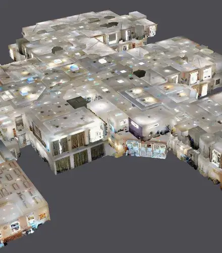
As digital engineering matures, survey data must be usable, not just technically correct. We provide clean, structured datasets aligned to software used by civil engineers, project managers and designers:
This supports faster modelling, easier collaboration and fewer manual edits for project teams.
Effective planning depends on a clear understanding of the land. Topographic and contour mapping, combined with digital terrain modelling, helps project teams identify constraints early, before they become costly downstream challenges.
Applications across civil engineering surveying:
With accurate terrain modelling, engineers reduce risk, anticipate design conflicts and make informed decisions from day one.
Across transport, utilities, water authorities and state government agencies, the use of geospatial data in constructionhas shifted from a “nice to have” to project-critical infrastructure. With large, multi-discipline projects increasingly relying on federated models, the demand for high fidelity spatial data is rising.
Major projects involve dozens of consultants and contractors working concurrently. Precise survey data ensures alignment between disciplines.
Engineering teams need confidence that measurement inputs are correct. Survey inaccuracy causes rework, disputes and contractual delays.
Better data at the start of the project improves the long-term operation and maintenance of assets, reducing lifecycle costs.
Digital twins, BIM coordination and long-term spatial data management now form part of most government and Tier 1 engineering scopes.
The most impactful geospatial solutions combine aerial perspective with ground-level precision. Landair’s hybrid workflow uses:
This approach delivers a complete understanding of the project environment, essential for engineers managing live sites, tight deadlines and high-risk assets.
From our brand values to the way our teams deliver projects, Landair’s entire approach centres on precision, responsiveness and long-term partnership
Clients consistently highlight our higher accuracy and rigorous checking as a point of difference.
Time is value, especially in construction. We deploy quickly and communicate clearly throughout the project.
From government corridors to industrial facilities, heritage structures and high-traffic sites, we’ve seen and solved, almost every surveying challenge.
With aircraft, drones, mobile scanners and static scanners, we recommend the right technology based on site conditions and required outputs, not the other way around.
Models align perfectly with existing conditions, reducing redesign hours.
Project teams resolve issues earlier using precise digital insight.
Accurate data at the start prevents expensive downstream mistakes.
Developers, engineers and government authorities gain assurance that the project is grounded in fact, not assumptions.
As Australia pushes ahead with ambitious infrastructure, renewable energy projects, transport upgrades and complex urban redevelopment, the need for reliable land surveying technology will only accelerate.
Drone mapping, 3D laser scanning, digital terrain modelling and advanced geospatial analysis are now central to achieving accuracy, safety and sustainability across the entire project lifecycle.
And as the sector evolves, Landair remains committed to “precision data powering progress”, supporting engineers, construction partners and government clients with data they can trust.