
Landair Surveys was engaged by heritage architecture firm Conservation Studio to conduct a full existing-conditions survey of the Mt Buffalo Chalet, Victoria’s largest timber structure and Australia’s first ski resort.
Built in stages from the early 1900s, the Mt Buffalo Chalet sits perched on Bent’s Lookout, offering sweeping views of the Victorian Alps. The expansive timber complex includes grand reception halls, a ballroom, and a billiards room, surrounded by a series of accommodation wings. After falling into disrepair in the early 2000s, the chalet is now undergoing restoration, with plans to reopen as a base for school camps and outdoor education.
Commissioned over two years by Parks Victoria, the surveying work was delivered in two major phases. The first mobilisation focused on the external site: 120 laser scanning setups were completed across all facades and accommodation wings, supported by a full feature survey of the surrounding terrain and RPA flyovers for high-resolution rooftop imagery.
A year later, the second mobilisation focused on the building interior. Two scanning teams spent two weeks onsite methodically recording all four levels of the chalet, including detailed capture of subfloor areas and ceiling cavities.
The resulting dataset included:
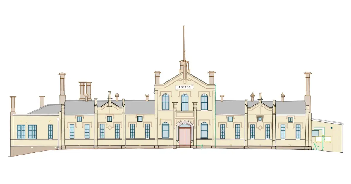
– Six sets of 2D plans: façades, floorplans, feature survey, ceiling cavity, subfloor, and building sections
– 400GB of high-density point cloud data
– High-resolution aerial imagery
This comprehensive dataset is now supporting Conservation Studio’s conservation planning and documentation efforts to bring Mt Buffalo Chalet back to life.
3D terrestrial laser scanning (internal and external)
Feature surveying
RPA drone imaging
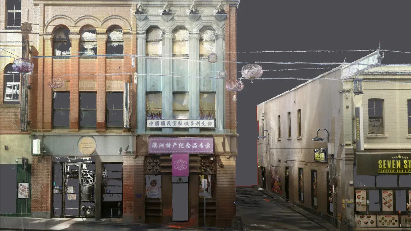
The Landair Survey team journeyed to the heart of China Town to measure the heritage facades at 109 Lt Bourke St on behalf of conservation specialists Conservation Studio.
Landair Surveys has partnered with a range of architecture, conservation, and construction professionals to deliver more than a decade’s worth of surveying projects across the University of Melbourne’s metropolitan and regional campuses.
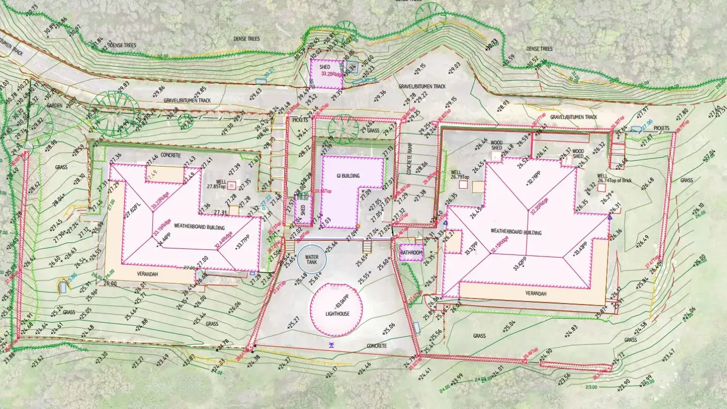
Heritage survey of Point Hicks Lightstation using 3D laser scanning and RPA flyovers to record the precinct for preservation.