
In quarrying and waste management, accurate data is everything. From excavation volumes to landfill capacity, decision-makers rely on reliable measurements to plan, build, and operate with confidence. An aerial land survey drone brings a new level of precision to this process, capturing high-resolution data from above to support efficient, safe, and cost-effective projects.
At Landair Surveys, we’ve seen how drone land surveying is transforming quarry and landfill projects by delivering survey-grade outputs in less time and with less disruption on site.
Quarries and landfills present unique challenges for surveyors: steep slopes, unstable surfaces, and large coverage areas. Traditional survey methods often require extended time on site and can expose surveyors to safety risks.
An aerial mapping drone overcomes these challenges by:
The result is a safer, more efficient survey workflow with no compromise on accuracy.
When deployed on quarry and landfill projects, drone surveying solutions can deliver a range of outcomes, including:
These outputs feed directly into CAD, GIS, and BIM platforms, giving engineers and operators the insights they need.
Drone photogrammetry is the process of stitching together hundreds or thousands of overlapping aerial images into a single 3D dataset. For quarry and landfill mapping, this means:
This approach combines the efficiency of aerial capture with the reliability of traditional survey control, ensuring outputs are accurate enough for engineering-grade decisions.
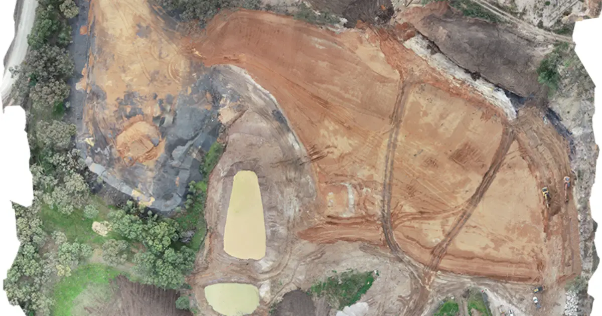
Landair was engaged for the Willow Tree Regional Landfill Facility Stage 1 Extension in New South Wales. The project involved creating a new landfill cell, requiring precise baseline data and continuous monitoring.
Our team:
The combination of traditional survey control and aerial mapping drone technology provided a verified dataset for engineers, supporting accurate construction, compliance, and long-term landfill management.
Beyond accuracy, drones deliver significant safety and efficiency benefits on quarry and landfill sites:
A drone flight that takes less than an hour can replace days of ground-based measurement.
Surveyors spend less time near heavy machinery, unstable slopes, or active landfill cells.
Operations can continue during aerial capture, avoiding costly downtime.
Regular flights allow operators to track changes over weeks or months without scheduling major survey campaigns.
For clients, this means faster decision-making and more reliable reporting.
At Landair Surveys, drones are never a standalone solution. They’re integrated into broader survey workflows. Every aerial land survey drone flight is tied to established ground control and overseen by licensed surveyors. This ensures:
This integration is what makes drones such a powerful tool for quarry and landfill mapping.
Yes. When tied to ground control, aerial mapping drones deliver centimetre-level accuracy suitable for volumetrics, compliance, and engineering design.
They reduce on-site risks, cover large areas quickly, and allow more frequent monitoring while maintaining survey-grade accuracy.
No. Drone surveying solutions complement, not replace, traditional methods. Licensed surveyors still provide the control, verification, and certifications required.
It depends on site activity. Many operators choose quarterly or monthly drone flights to monitor volumes, changes, and compliance.
Accurate data is the foundation of safe and efficient quarry and landfill operations. By combining drone topographic surveys, photogrammetry, and traditional survey control, an aerial land survey drone delivers precision, safety, and speed.
Learn more about our drone and RPA surveys.