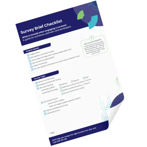
Planning to engage a surveyor for your next project? This practical checklist is designed for architects, planners, and developers to ensure your brief includes all the right details, helping you avoid delays, reduce rework, and get the data you actually need.
Whether you’re working on a heritage site, greenfield development, or urban project, this guide will help you ask the right questions from the start.
The Survey Brief Checklist is a free guide for architects, planners and developers that sets out what to include when engaging a surveyor. A clear brief ensures the right survey method is selected and delivered efficiently, whether for site plan architecture, 3D laser scanning or BIM-ready pointclouds.
Every survey quote starts with the same questions. Where is the site? What needs to be captured? What data deliverables are required to support your project? When those details are pinned down up front, the survey can be scoped and quoted accurately, and you avoid the delays and rework that come from re-scoping midway. Work through the checklist before you request a quote, or bring it to your first conversation with our team. Call 1300 130 158 if anything is unclear.
The checklist walks through each decision a survey brief needs to cover:
Brief in the detail your design work depends on: internal, external or roof scanning, the accuracy level the project calls for, and deliverables such as floorplans, facade elevation plans, reflected ceiling plans, pointclouds and 3D models in Revit or 3D DWG.
Scope the site information planning work relies on: a feature and level survey of site infrastructure and topography, overall aerial imagery for site context, and a title re-establishment survey to confirm boundary positions.
Cover the practical items that keep a development project moving: underground services tracing, RPA (drone) flyovers, monitoring surveys, project timeframes and any site access constraints that affect fieldwork.
The essentials are the project name, the site address or lot and plan number, the survey extent (a Google Earth markup or design plans work well), your timeframes, a key contact, and any site-specific constraints such as access issues or inductions.
That is expected, and the checklist allows for it: there is an option to tick unsure what scanner is best. Fill in what you know about the site and the outputs you need, and we will help you scope the right survey from day one. Call 1300 130 158.
A stationary scanner is set up on a tripod at each critical location and delivers accuracy of around +/-5mm, suiting projects where the finer details matter. A mobile scanner is wearable and captures as the surveyor walks, delivering accuracy of around +/-10mm with faster fieldwork across large areas.